


Stevenson étape 5

MMarie
Utilisateur
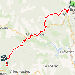

Longueur
28 km

Altitude max
1431 m

Dénivelé positif
828 m
Km-Effort
38 km

Altitude min
1020 m

Dénivelé négatif
626 m
Boucle
Non
Date de création :
2014-12-10 00:00:00.0
Dernière modification :
2014-12-10 00:00:00.0
7h53
Difficulté : Difficile

Application GPS de randonnée GRATUITE
 SityTrail
IGN / Instituts géographiques
SityTrail Plus
Le monde est à vous
À propos
Randonnée Marche de 28 km à découvrir à Occitanie, Lozère, La Bastide-Puylaurent. Cette randonnée est proposée par MMarie.
Description
La Bastide-Puylaurent aux Alpiers
20/O7/2012
Michel & Carmen
Localisation
Pays :
France
Région :
Occitanie
Département/Province :
Lozère
Commune :
La Bastide-Puylaurent
Localité :
Unknown
Départ:(Dec)
Départ:(UTM)
571792 ; 4938093 (31T) N.
Commentaires